Will anyone suffer by constantly exerting himself to learn?
Social Work as an academic discipline emphasis on learning from the field much before other academic disciplines realized its importance.Indeed the strength of the professional training lies on its field work learning. In field work everybody learns- not only the student trainees, but also the teachers.personally and professionally I learned a lot along with my students who were placed under my supervision.
But field work has its own limitations. Unless the students are self motivated it is impossible to motivate them if they decide to comply mechanically to the timings and report submission.
As a teacher of community development, I was assigned community settings for supervising the students. Not only the understanding the intricacies of community is beyond the comprehension of some of the students,the problem will get compounded if the students come from other than community development specialization.
An on average I used to get 20-22 students to guide for two semesters and out of these numbers one or two students are genuinely interested in field work.Supervising these students is always a pleasant experience. We will become co learners and develop a bond transcending teacher student relationship.
In the year 2007-08, I had some ten first year MSW students under my supervision and I decided to involve them in an idea which I was incubating for several years i.e. to understand an urban ward as a community.I selected K.Pudur (Ward No.5 of Madurai Corporation) out of convenience - located closer to our college, can be reached by walking.
Though in 2003 itself I made an attempt to involve students to understand an urban ward and I left it abruptly because I realized that it is beyond my capacity to motivate the students.
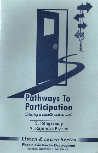
In 2003, I was relying only on participatory tools (see the brochure in slide presentation printed for that purpose).Since understanding an area can be facilitated only by using maps and government supplied eye sketches cannot be of much use for our purpose,I learned the art of making customized maps using GPS (for details see first visit to Mekkarai-Thanks to Dr.T. Pavendar of Madurai Kamaraj University and Dr.Gladwin of People's Action for Development, Vembar for their continuous support). Besides this, my exposure to the concept of ABCD (Asset Based Community Development) gave me enough confidence to "handle the student's interest" With this new experience I involved the students in an asset mapping exercise using participatory tools including PGIS.It was really a revealing experience worth for my entire life. We walked on almost all the streets, taking tracks and points using Garmin GPS and created a scalable maps which exactly overlapped with Yahoo as well as Google maps.Besides the facilitating skills for PLA,PGIS (Participatory Geo Information System) demands exposure to the ICT also.I realized ICT can be effectively used for social mobilization and empowerment.
As the proponents of the ABCD says, we realized the focusing on the strength of the communities is quite different from focusing on the problems of the community. Every community has its own strength and communities survives on their own. We learned when a foundation is laid for constructing physical structure,foundation for community life is also made simultaneously. The streets, lights, water and other public consumption facilities facilitate and regulate relationship within and outside the community. It is true "a community is a contributor of resources and allies and a provider of pitfalls and opponents". Within 400 ha of the ward area, we found more than 70 production units of various sizes, produces goods and services which enriches life of communities which they never seen. Apart from these,there are hundreds and hundreds of commercial establishments.We need to open all our senses in order to understand the meaning of the word "interrelationship" and "interdependency".Even to produce a broomstick to clean our houses,we need to depend on raw material from far away places,perfectly orchestrated by several people.There is a constant and dynamic interaction between people and places.What we learned is made us humble - realized the greatness of scholars and practitioners who dedicated their life to understand the communities and enriched our collective capacity to handle the community affairs with ease and economy.
We found that the ward is endowed with a rich social capital with more than 100 social associations and institutions.
I won't say that the ward is heavenly - we found poverty, conflict, exploitation, corruption and indifference.. Our communities,to put it Robert Chambers words, are complex, diversified and risk prone and to address this what we need need is open minded learning,innovative micro level experiments.

I thank the students who by their enthusiastic involvement proved that field work can be made as a pleasant experience. Is it not Field is our Supreme Teacher and work is our humble offering at the feet of our great master.
Wait for another post to learn the outcome of this field work in K.Pudur vegetable Market
But field work has its own limitations. Unless the students are self motivated it is impossible to motivate them if they decide to comply mechanically to the timings and report submission.
As a teacher of community development, I was assigned community settings for supervising the students. Not only the understanding the intricacies of community is beyond the comprehension of some of the students,the problem will get compounded if the students come from other than community development specialization.
An on average I used to get 20-22 students to guide for two semesters and out of these numbers one or two students are genuinely interested in field work.Supervising these students is always a pleasant experience. We will become co learners and develop a bond transcending teacher student relationship.
In the year 2007-08, I had some ten first year MSW students under my supervision and I decided to involve them in an idea which I was incubating for several years i.e. to understand an urban ward as a community.I selected K.Pudur (Ward No.5 of Madurai Corporation) out of convenience - located closer to our college, can be reached by walking.
Though in 2003 itself I made an attempt to involve students to understand an urban ward and I left it abruptly because I realized that it is beyond my capacity to motivate the students.
In 2003, I was relying only on participatory tools (see the brochure in slide presentation printed for that purpose).Since understanding an area can be facilitated only by using maps and government supplied eye sketches cannot be of much use for our purpose,I learned the art of making customized maps using GPS (for details see first visit to Mekkarai-Thanks to Dr.T. Pavendar of Madurai Kamaraj University and Dr.Gladwin of People's Action for Development, Vembar for their continuous support). Besides this, my exposure to the concept of ABCD (Asset Based Community Development) gave me enough confidence to "handle the student's interest" With this new experience I involved the students in an asset mapping exercise using participatory tools including PGIS.It was really a revealing experience worth for my entire life. We walked on almost all the streets, taking tracks and points using Garmin GPS and created a scalable maps which exactly overlapped with Yahoo as well as Google maps.Besides the facilitating skills for PLA,PGIS (Participatory Geo Information System) demands exposure to the ICT also.I realized ICT can be effectively used for social mobilization and empowerment.
As the proponents of the ABCD says, we realized the focusing on the strength of the communities is quite different from focusing on the problems of the community. Every community has its own strength and communities survives on their own. We learned when a foundation is laid for constructing physical structure,foundation for community life is also made simultaneously. The streets, lights, water and other public consumption facilities facilitate and regulate relationship within and outside the community. It is true "a community is a contributor of resources and allies and a provider of pitfalls and opponents". Within 400 ha of the ward area, we found more than 70 production units of various sizes, produces goods and services which enriches life of communities which they never seen. Apart from these,there are hundreds and hundreds of commercial establishments.We need to open all our senses in order to understand the meaning of the word "interrelationship" and "interdependency".Even to produce a broomstick to clean our houses,we need to depend on raw material from far away places,perfectly orchestrated by several people.There is a constant and dynamic interaction between people and places.What we learned is made us humble - realized the greatness of scholars and practitioners who dedicated their life to understand the communities and enriched our collective capacity to handle the community affairs with ease and economy.
We found that the ward is endowed with a rich social capital with more than 100 social associations and institutions.
I won't say that the ward is heavenly - we found poverty, conflict, exploitation, corruption and indifference.. Our communities,to put it Robert Chambers words, are complex, diversified and risk prone and to address this what we need need is open minded learning,innovative micro level experiments.

I thank the students who by their enthusiastic involvement proved that field work can be made as a pleasant experience. Is it not Field is our Supreme Teacher and work is our humble offering at the feet of our great master.